


وصف لـ Austrian Map mobile
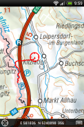
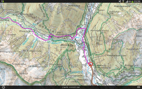
The Austrian Map mobile (AMap mobile) contains the digital maps of Austria including hill shading, geographic names database “Geonam” and the digital elevation model. This digital product of the Bundesamt für Eich- und Vermessungswesen (BEV) offers high quality topographic maps and a user-friendly interface with extensive functionality.
Maps and data available in the Austrian Map mobile:
* Overview Map 1:1 Million (free of charge)
* Cartographic model 1:500 000 (free of charge)
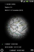
* Cartographic model 1:250 000
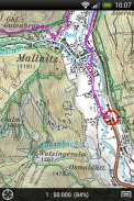
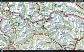
* Cartographic model 1:50 000
The app contains a map tile contingent of 550 tiles, which corresponds to 550 km ² in the scale 1:50 000 (no specific area, maps free to choose). This allows to test the capabilities of the AMap mobile in a specific area. Additional areas may be downloaded at will.
Functions of Austrian Map mobile:
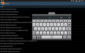
* Search by toponym or search by coordinates
* GPS features: Display of the location, "moving map", compass support, routing along tracks
* Insert, edit and share POIs (Points of Interest)
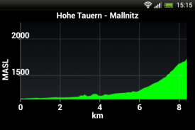
* Recording and exporting tracks (tracks can be imported into AMap Fly)
* meta data about the used map sheets
خريطة المحمول النمساوي (AMAP الجوال) يحتوي على خرائط رقمية من النمسا بما في ذلك التظليل التل، أسماء الجغرافية قاعدة بيانات "Geonam" ونموذج الارتفاع الرقمي. هذا المنتج الرقمي للبوندسمت FÜR Eich- اوند Vermessungswesen (بيف) يوفر جودة عالية الخرائط الطبوغرافية واجهة سهلة الاستخدام مع وظيفة واسعة النطاق.
الخرائط والبيانات المتاحة في النمسا خريطة الجوال:
* نظرة عامة الخريطة 1: 1 مليون (مجانا)
* رسم الخرائط نموذج 1: 500 000 (مجانا)
* رسم الخرائط نموذج 1: 250 000
* رسم الخرائط نموذج 01:50 000
يحتوي التطبيق فرقة خريطة البلاط من 550 البلاط، والتي تتطابق إلى 550 كم ² في نطاق 1:50 000 (أي منطقة معينة، خرائط مجانية لاختيار). وهذا يسمح لاختبار قدرات AMAP المحمول في منطقة معينة. يمكن تنزيل مناطق إضافية في الإرادة.
وظائف النمساوي خريطة الجوال:
* البحث حسب جغرافي أو البحث عن طريق الإحداثيات
* ميزات GPS: عرض موقع "خريطة التحرك"، والدعم البوصلة، التوجيه على طول المسارات
* إدراج وتحرير ومشاركة النقاط المهمة (نقاط الاهتمام)
* تسجيل ومسارات تصدير (يمكن استيراد المسارات في منطقة القطب الشمالي يطير)
* البيانات الفوقية عن صحائف خريطة استخدامها
Austrian Map mobile - إصدار 2.1.3
(20-10-2022)Austrian Map mobile - معلومات APK
نُسخة APK: 2.1.3الحزمة: com.garzotto.ammaتطبيقات من الفئة نفسها
قد يعجبك أيضًا...


